


Croydon to Woldingham
Sat 24th Feb 2018
Walk Details:
Taking in Croham Heights, Purley Beeches and Old Coulsdon in the morning; then Farthing Downs, Happy Valley, Chaldon Church and North Downs Way in the afternoon
Entry Details:
Walk Report
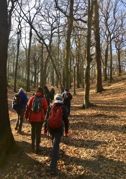
Croydon to Woldingham, Saturday 24th February 201823 walkers, 18 miles - leader Dave Williams
23 walkers (including 2 laggards!) turned up to help the leader celebrate his 54th birthday.
Suffice to say that no one was left disappointed (well, nearly no one!) as the walk had something to please all tastes including a death-defying descent, spectacular tumbles, plenty of culture (the leader's speciality!) & to top it all a master class in leadership skills!!
Against all the odds everyone survived, the only casualty being one poor soul who tried to negotiate one of the descents on his backside!
And to top it all we reached the finish in daylight having covered just on 18 miles.
The mean average age of the Group was approximately 105!!!
Photograph by Keith Lane; more by Gavin Fuller on the group Facebook page
(nb treat a number of the statements in this report with extreme caution)
Other Files
Download Walk ReportGPX
A GPX file of the above route may be downloaded by clicking the link below.
Note: GPX files of Group Walks are created by LDWA Group members, and may be downloaded only by other LDWA members. They should not be made available outside the LDWA, and are used at members' own risk.
Login to Download (Members Only)You can use the interactive controls to zoom in and out and to move around the map, or click on a path or a marker for more info. (interactive map help)
You can use the interactive controls to zoom in and out and to move around the map, or click on a path or a marker for more info. (interactive map help)
© OpenStreetMap contributors under Open Database Licence
Rights of way data from selected Local Authorities
Large scale digital mapping is provided by John Thorn
At high zoom levels the route is indicative only.
Gallery
Maps:
You can use the interactive controls to zoom in and out and to move around the map, or click on a marker for more info. (interactive map help)
© OpenStreetMap contributors under Open Database Licence.
Rights of way data from selected Local Authorities.
Large scale digital mapping is provided by John Thorn.


