


Rickmansworth circular
Sun 28th Jan 2018
Walk Details:
Event Details Updated
Update 18/1
Note following changes compared to "Strider" and which have been incorporated in walk details above:
1) Rail works (no Met line trains); 2) Earlier start time (09.25 not 09.30); 3) More details on route and mud update; 4) Lunch and other refreshment details added (NB packed lunch not pub lunch as advertised in "Strider")
Event Type
Group Walk
Region
Southern England
Local Group
London
Distance
20ml.
Start Time
09.25
Route
Start and finish outside Rickmansworth Station. *** NOTE RAIL WORKS THIS WEEKEND: No Metropolitan Line trains between Aldgate and Wembley Park. Use the 08.57 Chiltern Line service from Marylebone arriving 09.19 or Jubilee line to Wembley Park and change to an Amersham or Chesham train (not Uxbridge or Watford) arriving Rickmansworth 09.12 ***
The walk is an undulating, counter clockwise, loop of the town of Rickmansworth, going by way of the Colne Valley, Croxley Green, Church End, Chorleywood, Harefield and Moor Park golf course. Generally reasonable going but muddy in a few places with one section offering deep mud and saturated ground. Wetherspoons - The Pennsylvanian in Rickmansworth High Street
General Notes
Packed lunch in the open. A pub stop for refreshments will be made but not necessarily at lunchtime
Web Site
Start and Finish
Entry Details:
Cost
Walk Report
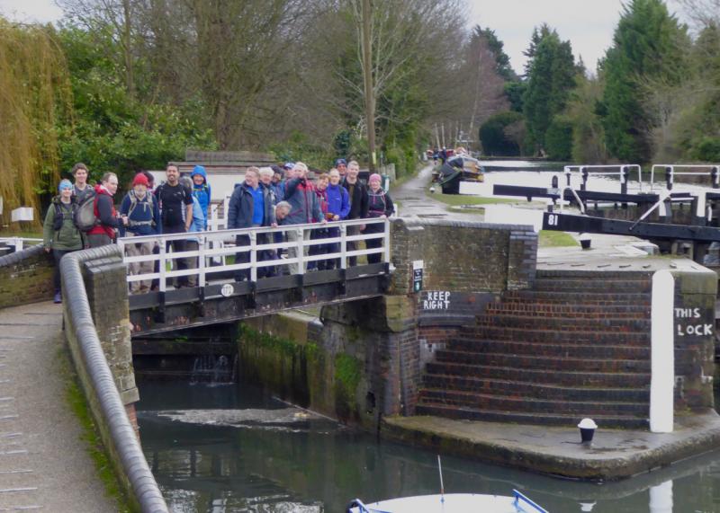
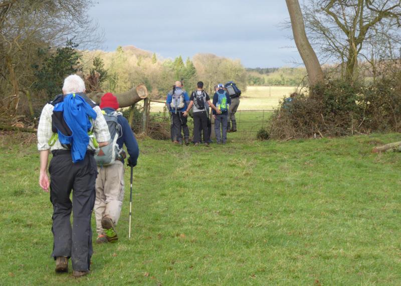
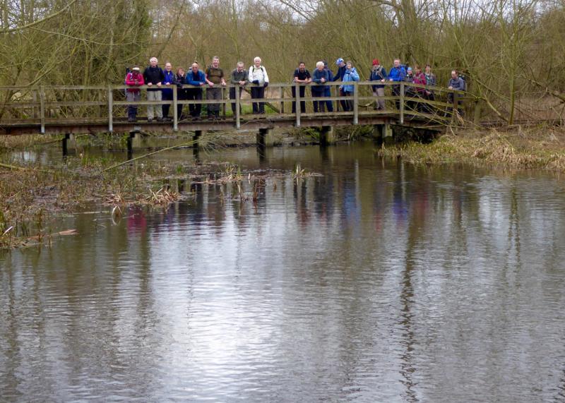
Rickmansworth Circular, Sunday 28th January 201821 walkers, 19 miles - leader Godfrey O'Callaghan
21 people turned out for the walk from Rickmansworth on Sunday. The day started dull and cloudy and mainly stayed that way except for a couple of hours earlier on. The walk first headed through the town, stopping to take in the Wetherspoon's on the way - named after William Penn, founder of Pennsylvania, who once lived in Rickmansworth High Street. From there it was on to the canal before turning uphill and inland by way of Croxley Green. A navigational error at one point took us through a private wood where we found the most magnificent display of Snowdrops where followed a polite conversation with the lady of the manor on who's estate we had blundered. On then, across an open landscape to Church End where we had a short break and some lucky enough to be offered spare coffee at the church. From there we dropped down to the Chess Valley before climbing to Chorleywood common and The Swillet. Further on we passed a construction site for HS2. Lunch was in the open overlooking one of the many lakes along the valley. Water birds provided some good entertainment. The route then joined the Hillingdon trail and, a little later, the London Loop where some worthwhile mud was found. A descent of Moor Park golf course proved a fitting finale, crossing clean earth and passing the stunning Grade I listed Palladian mansion, now the Moor Park Golf Club club house. Once more back in Rickmansworth data from various devices was discussed and a consensus reached that the distance was 19 miles - or as near as dammit!
Photographs by Godfrey O'Callaghan; more by Emma Hope Maccormick on the group Facebook page
Other Files
Download Walk ReportGallery
Maps:
You can use the interactive controls to zoom in and out and to move around the map, or click on a marker for more info. (interactive map help)
Contains Ordnance Survey data © Crown copyright and database right 2016.
© OpenStreetMap contributors under Open Database Licence.
Rights of way data from selected Local Authorities.
Large scale digital mapping is provided by John Thorn.
© OpenStreetMap contributors under Open Database Licence.
Rights of way data from selected Local Authorities.
Large scale digital mapping is provided by John Thorn.


