


Saxon Shore backwards (linear)
Sat 9th Dec 2017
Walk Details:
Follow the Saxon Shore Way 'in reverse' to Gravesend station , following the Medway before crossing the Hoo peninsula to the banks of the Thames
Entry Details:
Walk Report
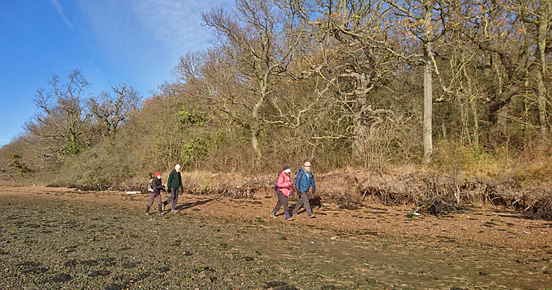
Saxon Shore Backwards, Saturday 9th December 201718 walkers, 20 miles - leader Peter Aylmer
Three castles, two estuaries, and a national nature reserve. Except that the leader got it wrong in his briefing and there are in fact not three castles but two (one of which is the home of Jools Holland), though to make up for it there are two Thames-side forts near the end, which once guarded London against intruders down its river. This is a walk that's far better on the ground than it looks on the map - by no means just a plod round an estuary: first, the tidal foreshore of the Medway, then a slight rise by green lane to Northward Hill, not only a nature reserve but a glorious viewpoint for a magnificent Thames panorama from Southend to Tilbury and beyond. Lunch in a super local pub, the Horseshoe & Castle in Cooling, with a literary diversion after to the village churchyard, site of Dickens' superbly scary opening scene in Great Expectations where Magwitch grabs Pip by the collar. And to cap it all, a splendid winter's day, chilly but bright.
Photographs by Peter Aylmer; more by Bola Baruwa and Gavin Fuller on the group Facebook page
Other Files
Download Walk ReportGPX
A GPX file of the above route may be downloaded by clicking the link below.
Note: GPX files of Group Walks are created by LDWA Group members, and may be downloaded only by other LDWA members. They should not be made available outside the LDWA, and are used at members' own risk.
Login to Download (Members Only)You can use the interactive controls to zoom in and out and to move around the map, or click on a path or a marker for more info. (interactive map help)
You can use the interactive controls to zoom in and out and to move around the map, or click on a path or a marker for more info. (interactive map help)
© OpenStreetMap contributors under Open Database Licence
Rights of way data from selected Local Authorities
Large scale digital mapping is provided by John Thorn
At high zoom levels the route is indicative only.
Gallery


Maps:
You can use the interactive controls to zoom in and out and to move around the map, or click on a marker for more info. (interactive map help)
© OpenStreetMap contributors under Open Database Licence.
Rights of way data from selected Local Authorities.
Large scale digital mapping is provided by John Thorn.


