
A Social Kanter
Sun 2nd Jul 2017
Walk Details:
Event Details Updated
More detail
Event Type
Group Walk
Region
Southern England
Local Group
Thames Valley
Distance
12-24ml.
Start Time
08.30
Route
Cowleaze c.p. North End
General Notes
We congregate at the start as with any Sunday walk with the aim to start walking at 09:00 and finish between 16:00 and 17:00, when cakes will be available. The difference is we will initially split into groups; how large or small is entirely up to you, although one in each group will need to be proficient at navigating with a map and using grid references. Each group will be issued with a list of grid references and clues to be answered. The list of grid references is in the order of a full 24-mile circuit that includes 3,500ft of climb, with information to shorten to 14 or 19 miles. However you are free to determine your own route, distance and order of visiting the grid references if you so wish. If anybody wishes to do the walk on their own please carry a mobile phone and book in at the start and out on completion with Steve Mee. Bring map, compass and pencil. Clues will be answered at 17:00
Web Site
Start and Finish
Entry Details:
Cost
Walk Report
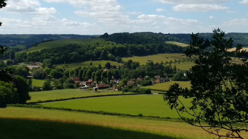
Article and photo by Helen Abbott.This was another social Kanter from Cowleaze Wood along the same lines of one held last summer under the auspices of the group's 40th Anniversary celebrations. It was still billed as the Krazy Kowleaze Kanter on the handout, so perhaps the moniker has stuck!
This year's full route was an estimated/ideal 24 miles (my version ended up as 25.2) with 3,500 feet of height gain. Anyone aspiring to do the whole distance in the 8 hours especially navigating on their own (me) should take note that this is almost as far and with more ascent than a typical Chiltern Marathon, and that all the small hesitations of route-finding, clue-finding and more (below) add up to a surprisingly large overhead. The route did though allow for cut-offs to shorter distances which not only improved the chances of getting back in time for cake (and the clue answers) but allowed for coffee on the way!
Just plotting 26 grid references in half an hour and having some idea where the route went was a challenge in itself for the inexperienced.
The jury is probably still out on whether a GPS, a phone, an OS map, or expert local knowledge including a large number of short cuts, is the best method. I had the first 3 and plotted the GRs on the GPS as waypoints. A map may have given a better overview but with the GPS on hand to be more precise over the 8-digit GRs and the clues needing the more finely tuned observation skills. Interestingly though the OS map gave less detail of all the tracks within the nature reserve than the devices' Open Streetmap mapping.
Without blaming this for my out of time finish, I did have one of the more bizarre "What are you doing" conversations en route. A resident very rightly was wondering why on one random Sunday morning a succession of people was rushing along, peering intently into his property looking for something to do with an abandoned boat, scribbling something and then rushing away. I desisted from doing likewise and missed the clue, conveniently concluding that the "Row" in Aston Rowant must be the answer, but almost gave up at that point, only half a mile in.
The resident asked whether we were all on a treasure hunt. I think if I had replied, no this was the KKK, the reaction may have been something different.
Gallery
Maps:
You can use the interactive controls to zoom in and out and to move around the map, or click on a marker for more info. (interactive map help)
Contains Ordnance Survey data © Crown copyright and database right 2016.
© OpenStreetMap contributors under Open Database Licence.
Rights of way data from selected Local Authorities.
Large scale digital mapping is provided by John Thorn.
© OpenStreetMap contributors under Open Database Licence.
Rights of way data from selected Local Authorities.
Large scale digital mapping is provided by John Thorn.


