


POP UP An escape from Romford -MIDWEEK DAYTIME WALK (Linear)
Wed 9th Nov 2016
Walk Details:
Event Details Updated
This is a late entry to the programme - not in "Strider"
Event Type
Group Walk
Region
Southern England
Local Group
London
Distance
11ml.
Start Time
10.35
Route
Meet Romford Station 10:35 (leader on 10:33 arrival from Upminster). Finish: Fairlop Station (Central Line or Bus 247 to Romford)
Mainly through town and country parks
General Notes
Light refreshments at 3 and 8 miles and extended by request to 'The New Fairlop Oak'
Web Site
Start
Finish
Entry Details:
Cost
Walk Report
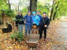
Escape from Romford, Wednesday 9th November 20166 walkers including one guest, 11 miles - leader Ron Williamson
The forecasted weather for today suggested that it would be a good time to assess the effectiveness of our waterproof gear. Six staunch walkers agreed to take part in the research, with at least one other, known to the leader, declining the offer.
A variety of rain ware was evident as we departed Romford station at 10:40 but alas within 400 yds. the rain ceased only to appear spasmodically throughout the day.
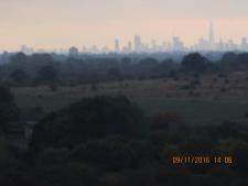
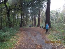
Our route soon entered Lodge Farm Park, virgin territory to all including the leader, and then onwards through Raphael Park, Rise Park and into Bedfords Park with its first class information centre and tea rooms.
Suitably refreshed we headed for the historic village of Havering Atte Bower from where the London LOOP was followed through Havering Country Park into Hainault Forest.
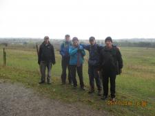
Another refreshment stop at the cafe by the lake and it was time for the final two miles to Dave's home territory, making time to divert through Hainault Recreation Ground and the county park of Fairlop Waters before finishing naturally at the local Wetherspoons about 15:15.
Unfortunately waterproofs were not tested! so this task is reluctantly passed on to the next group of admirable volunteers.
Other Files
Download Walk ReportGallery


Maps:
You can use the interactive controls to zoom in and out and to move around the map, or click on a marker for more info. (interactive map help)
Contains Ordnance Survey data © Crown copyright and database right 2016.
© OpenStreetMap contributors under Open Database Licence.
Rights of way data from selected Local Authorities.
Large scale digital mapping is provided by John Thorn.
© OpenStreetMap contributors under Open Database Licence.
Rights of way data from selected Local Authorities.
Large scale digital mapping is provided by John Thorn.


