


Going Loopy part 2 (linear)
Sat 4th Feb 2017
Walk Details:
Event Details Updated
Update 14/1/17:
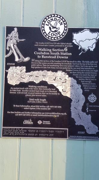
*** Trains: All should be running as timetabled. Only an hourly train out of Banstead but all being well we will make the 1738 to Victoria. There is an alternative station at Coulsdon South, approx 16 miles, for anyone who needs an earlier finish.
*** Sights: Include one of the great London views from the Addington Hills, Selsdon Wood, Happy Valley and Farthing Down, plus the back end of High Down Prison, which we will almost certainly pass in near-darkness.
*** Kit: please bring a torch, but you are advised not to lend to anyone wearing HMP overalls, just in case you never see it again.
*** Lunch: There is a pub about 12 miles in, where we may pay a short visit if we are making reasonable time, but it might be a good idea to have a sandwich as well as the usual water etc. just in case.
Event Type
Group Walk
Region
Southern England
Local Group
London
Distance
21ml.
Start Time
09.15
Route
Meet Hayes (Kent) station (0832 from Charing Cross, 0835 Waterloo East, 0840 London Bridge). Finish at Banstead station. If using a Travelcard, zone 6 is needed for Banstead
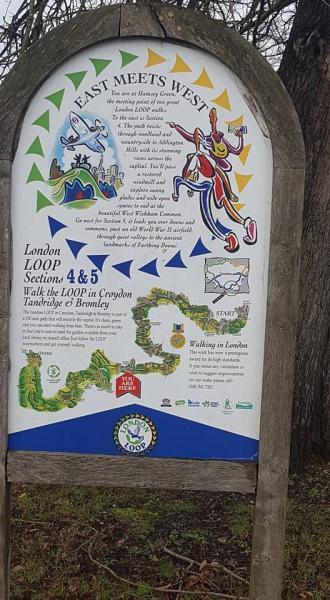
Stages 4 to 6 of the London Loop, including much fine downland on the capital's southern edges
General Notes
Bring head torch as the walk is likely to finish after dark. Lunch TBC [See "Stop Press"]
Web Site
Start
Finish
Entry Details:
Cost
Walk Report
Going Loopy Part 2: Hayes to Banstead, Saturday 4th February 201720 walkers, 21 miles - leaders Peter Aylmer & Neil Cook
Peter Aylmer was due to lead this walk but due to "Delhi Belly" he decided to drop out at Addington Hills after our first photo call from the viewing platform looking towards London (not much could be seen).
We continued through mud and yes sunshine to Kenley for lunch. We set off later than intended towards Coulsdon via Happy Valley. 4 walkers dropped out at Coulson South, the remainder continued on towards Banstead.
Report by Neil Cook
Photographs by Bola Baruwa; more by Bola on the group Facebook page
Other Files
Download Walk ReportGallery


Maps:
You can use the interactive controls to zoom in and out and to move around the map, or click on a marker for more info. (interactive map help)
Contains Ordnance Survey data © Crown copyright and database right 2016.
© OpenStreetMap contributors under Open Database Licence.
Rights of way data from selected Local Authorities.
Large scale digital mapping is provided by John Thorn.
© OpenStreetMap contributors under Open Database Licence.
Rights of way data from selected Local Authorities.
Large scale digital mapping is provided by John Thorn.


