


!!! POP UP !!! Sevenoaks Circular
Tue 22nd Mar 2016
Walk Details:
A pop-up stroll at 3mph; not more than 11 miles in beautiful Kent countryside far from the madding crowd with hills and fine views via Knole Park, Seal Chart, and Ightham Mote; returning via the Greensand Way to Sevenoaks Station by 1600. Bring your own lunch (may be possible to sit at tables outside), or eat in the National Trust café at Ightham Mote; bring National Trust cards if you wish to visit the property briefly
Entry Details:
Walk Report
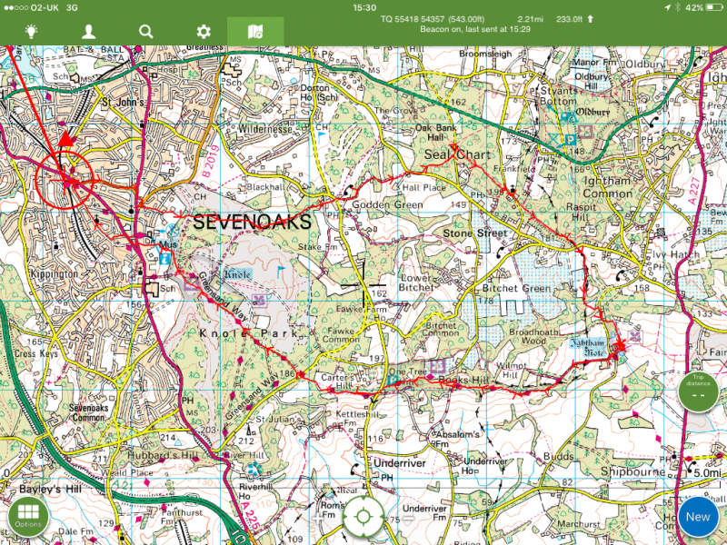
Sevenoaks Circular, Tuesday 22nd March 20164 walkers, 11 miles - leader Roderick Smith
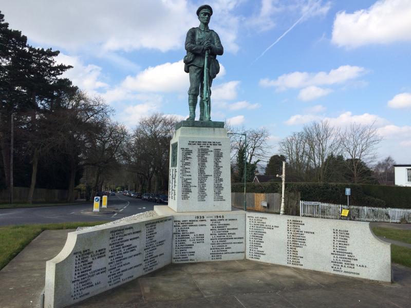
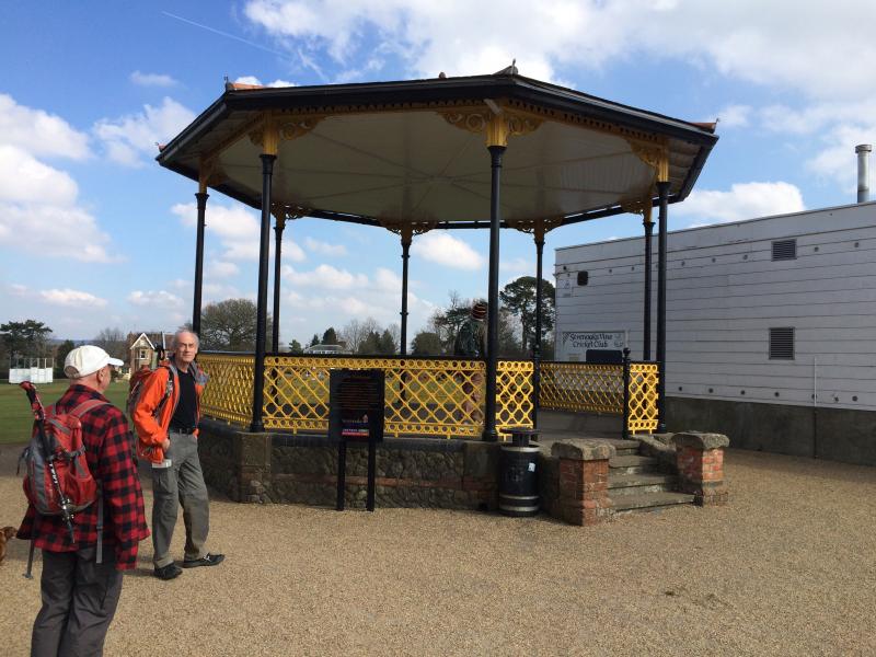
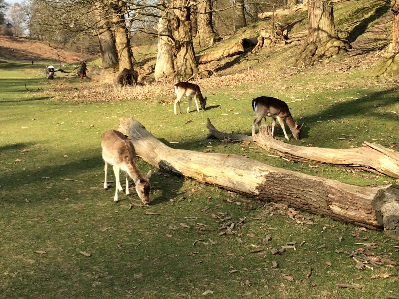
Tuesday 22 March 2016. Four members caught trains at 1015 from Charing Cross and Waterloo East and met at Sevenoaks Station. The walk started at 1100 and went uphill to Sevenoaks War Memorial and the Vine Cricket Club (c.1734) before crossing rugby grounds and descending into Knole Park (National Trust and Sackville Family home). Through herds of deer and across the golf course to Godden Wood and on to pass the Bucks Head Inn.
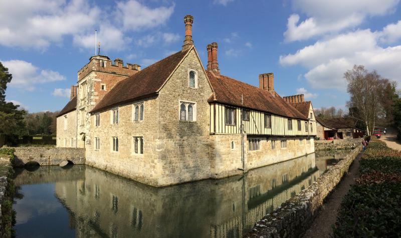
After a short climb near Seal Chart we followed a wooded greensand ridge past St Lawrence Church before plunging off the ridge down to Ightham Mote completing 5 miles in two hours. After a 40-minute lunchbreak at their National Trust cafe we joined the Greensand Way to return to Knole.
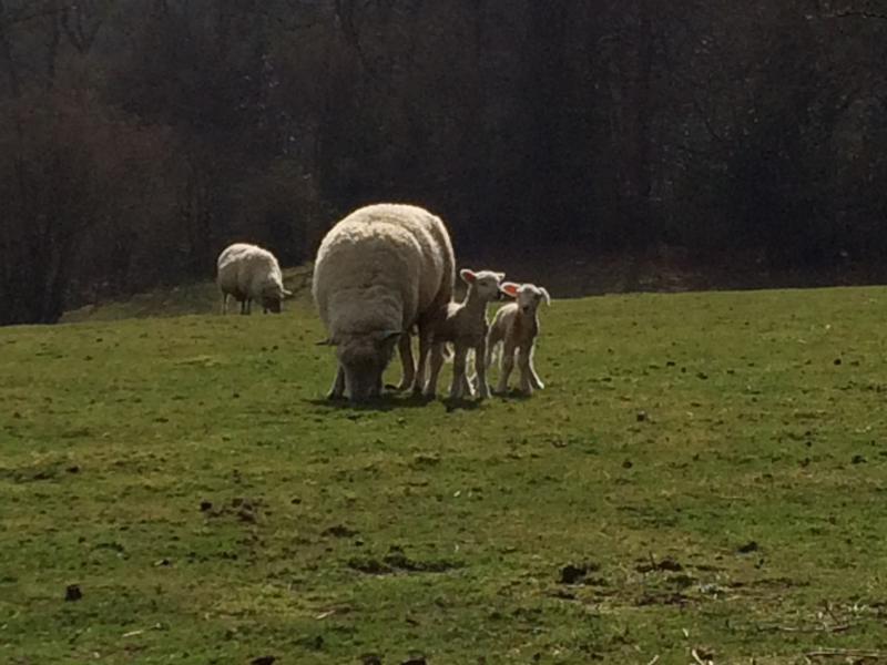
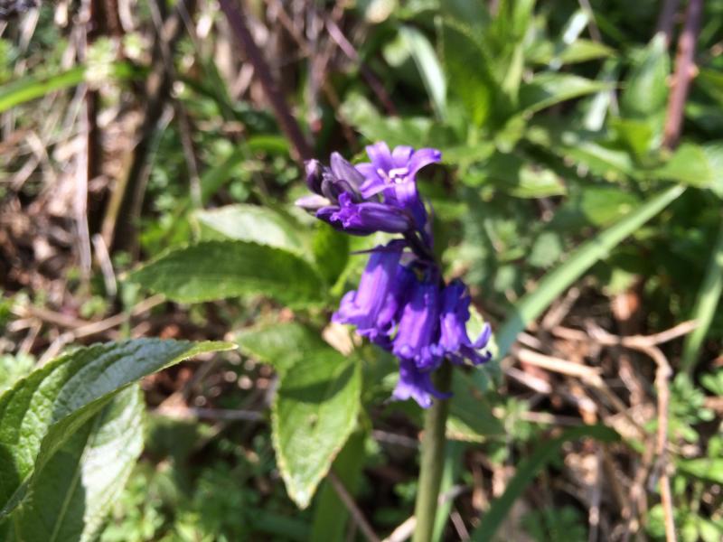
There were far-reaching views of 30 miles to the whale-backed South Downs with sparkling warm spring sunshine as well as bluebells in flower and very young lambs to delight the eye. Downhill through Sevenoaks to the station saw us just catch the 1530 train, returning to Charing Cross by 1600. A fine short notice walk on dry ground covering more than 10 miles in 4.5 hours.
Photographs by Adam Dawson
Other Files
Download Walk ReportGPX
A GPX file of the above route may be downloaded by clicking the link below.
Note: GPX files of Group Walks are created by LDWA Group members, and may be downloaded only by other LDWA members. They should not be made available outside the LDWA, and are used at members' own risk.
Login to Download (Members Only)You can use the interactive controls to zoom in and out and to move around the map, or click on a path or a marker for more info. (interactive map help)
You can use the interactive controls to zoom in and out and to move around the map, or click on a path or a marker for more info. (interactive map help)
© OpenStreetMap contributors under Open Database Licence
Rights of way data from selected Local Authorities
Large scale digital mapping is provided by John Thorn
At high zoom levels the route is indicative only.
Gallery


Maps:
You can use the interactive controls to zoom in and out and to move around the map, or click on a marker for more info. (interactive map help)
© OpenStreetMap contributors under Open Database Licence.
Rights of way data from selected Local Authorities.
Large scale digital mapping is provided by John Thorn.


