


Downe South (Linear) ***NOTE CHANGED START AND TRAVEL***
Sat 11th Jun 2016
Walk Details:
Event Details Updated
NOTE LATER START TIME (because of rail replacement service) and also extra lunch option at café
DETAILS: We'll stay on the 0836 from Charing Cross / 0839 from Waterloo East but alight at Grove Park (0901). Here, catch the rail replacement bus service (0910) which gets to Chislehurst station 0925. We'll now start the walk at 0930 instead of 0905
Event Type
Group Walk
Region
Southern England
Local Group
London
Distance
20ml.
Start Time
09.30 (NOT 09.05)
Route
Meet Chislehurst stn (depart Charing Cross 08.36 or Waterloo East 0839, WITH RAIL REPLACEMENT SERVICE - see below), finish New Addington tram stop, frequent trams back to East Croydon stn
Passes Darwin's home Down House and several sites where the great naturalist found evidence for the theory of evolution
General Notes
Lunch Downe village (choice of pubs or a café). The first of four walks in three weeks based on the leader's forthcoming Cicerone guide to London. Registered assistance dogs only
Web Site
Start
Finish
Entry Details:
Cost
Walk Report
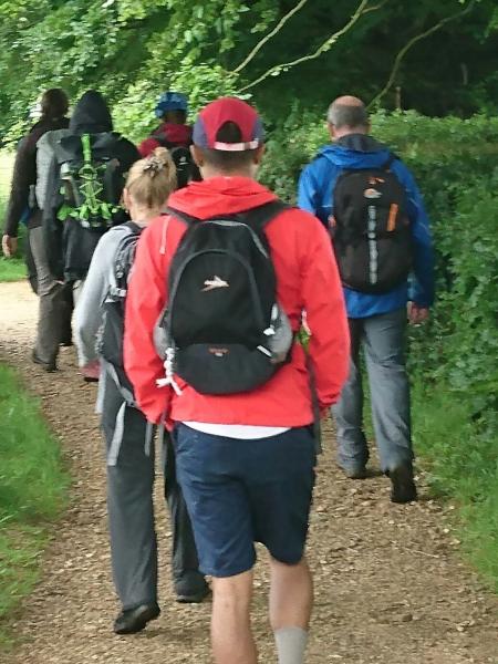
Downe South, Tuesday 11th June 201613 walkers, 19 miles - leader Peter Aylmer
With National Trust woodlands, any number of nature reserves, a bijou village at lunch time and the haunts of Charles Darwin as a centre piece, there was always going to be plenty of interest as we explored London's south-eastern outer reaches, but it just so happened that a very 21st century display totally stole the show.
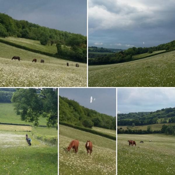
From Chislehurst station (reached alas by rail replacement bus service), we headed up into Petts Wood, the ancient woodland rather than the commuter suburb of the same name. We passed a memorial to Francis Edlmann who in 1927 purchased the wood in order to stop it being turned into yet more housing. From here the London Loop took us through Farnborough and its pretty churchyard to the High Elms country park - alas no high elms these days. Leaving the Loop, we reached the giddy height of over 550ft before dropping into a downland hanger. On the hanger's upslope we crossed Downe Bank, where Darwin carried out much of the research which led to his theory of evolution.
Over lunch at the Queen's Head in Downe, a rumble of thunder showed how unstable the weather was, but though we had an hour of two of afternoon rain, it never reached torrential proportions. We passed Darwin's home Down House and even had a quick peep into his back garden plus a spin on his 'thinking walk' before contouring round above the West Kent golf club, perhaps the only golf club whose rough is a London Wildlife Trust reserve. It was here we saw Spitfires and a B17 performing above the nearby Biggin Hill airfield. But better was to come.
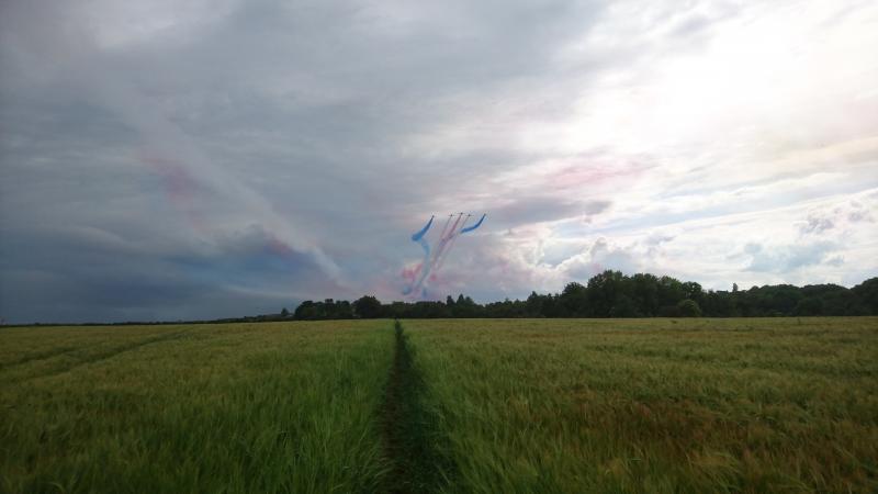
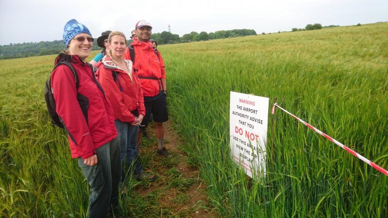
As we crossed a dripping wet cornfield, the Red Arrows team set off for their part in Biggin Hill's air show. We soon realised the cornfield was set aside as their crash space - warning signs and tape were in place beside the right-of-way we were following. For half an hour the Arrows wheeled, soared and gyrated in the skies immediately above us - fair to say we didn't rush this stretch! We certainly had a better view than those on the airfield itself, and it was quite the most remarkable half-hour for any LDWA walk.
Beyond Leaves Green and a down-and-up through another downland jewel, it was clear just how much time we'd lost while admiring the aeronautics. We saved a mile at the end by diverting north through Frylands Wood instead of the planned route through Frith Wood, though both are equally delightful, before one last rise (2,000ft of ascent over the day) up Hutchinson's Bank, a hotspot for rare orchids. That left one last wildlife sighting to be made, the New Addington gorilla. It's a wood carving near the tram stop, but one or two might have been worried just for a moment.
Photographs by Peter Aylmer, Dalbir and Steve Lannon
Other Files
Download Walk ReportGallery


Maps:
You can use the interactive controls to zoom in and out and to move around the map, or click on a marker for more info. (interactive map help)
Contains Ordnance Survey data © Crown copyright and database right 2016.
© OpenStreetMap contributors under Open Database Licence.
Rights of way data from selected Local Authorities.
Large scale digital mapping is provided by John Thorn.
© OpenStreetMap contributors under Open Database Licence.
Rights of way data from selected Local Authorities.
Large scale digital mapping is provided by John Thorn.


