


Godalming circular -- hills and commons
Sat 23rd Apr 2016
Walk Details:
R Wey Nav, Winkworth Arboretum, Hambledon, Witley, Thursley Common, Eashing
Entry Details:
Walk Report
Godalming Circular - Hills and Commons, Saturday 23rd April 201615 walkers, 18.5 miles - leader Jennifer Caddy
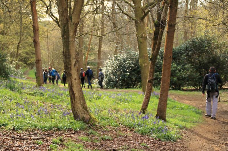
Bluebells were a feature on the walk. Enough were in flower in some woods to give a noticeable carpet of blue.
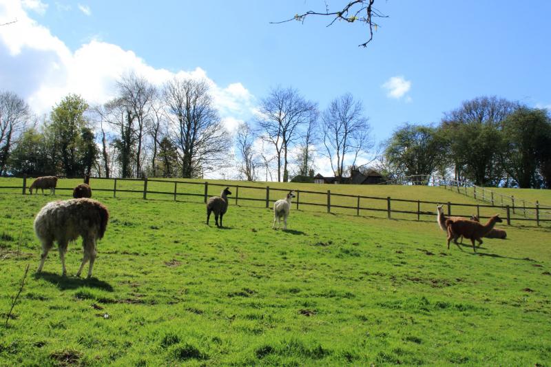
It was a cool, cloudy day with occasional bursts of sunshine but no rain. Most paths were dry but one was awash with mud. Fortunately, there was a well-trodden escape route up the bank. As we squeezed between trees and a fence, nine llamas in the adjacent field spotted us and stared.
From Godalming station we headed east by the River Wey Navigation, turned south to Munstead and Thorncombe Street, entered Winkworth Arboretum and walked along the public footpath to the cafe where we stopped for refreshment. After this we continued to Hydon Heath, climbed up Hydon's Ball for a view of the South Downs, passed the church at Hambledon, crossed Buss's Common and arrived at Witley, our stop for lunch. Some ate in the pub; the rest ate in the churchyard where the peace was soon disturbed by a man cutting the grass.
After lunch we took a route through Witley, Thursley and Rodborough Commons, walked briefly alongside the River Wey as a large group of people headed downstream in canoes and on paddle boards, joined the Fox Way and continued to Godalming station. We arrived there at 4.15pm in time for the 4.25pm train back to London.
Photographs by Gavin Fuller
Other Files
Download Walk ReportGPX
A GPX file of the above route may be downloaded by clicking the link below.
Note: GPX files of Group Walks are created by LDWA Group members, and may be downloaded only by other LDWA members. They should not be made available outside the LDWA, and are used at members' own risk.
Login to Download (Members Only)You can use the interactive controls to zoom in and out and to move around the map, or click on a path or a marker for more info. (interactive map help)
You can use the interactive controls to zoom in and out and to move around the map, or click on a path or a marker for more info. (interactive map help)
© OpenStreetMap contributors under Open Database Licence
Rights of way data from selected Local Authorities
Large scale digital mapping is provided by John Thorn
At high zoom levels the route is indicative only.
Gallery

Maps:
You can use the interactive controls to zoom in and out and to move around the map, or click on a marker for more info. (interactive map help)
© OpenStreetMap contributors under Open Database Licence.
Rights of way data from selected Local Authorities.
Large scale digital mapping is provided by John Thorn.


