
Fun & Games in and around Hambleden
Sun 6th Dec 2015
Walk Details:
Event Type
Group Walk
Region
Southern England
Local Group
Thames Valley
Distance
c14ml.
Start Time
09.00
Route
From c.p. behind Stag & Huntsman p.h. Hambleden
General Notes
Christmas walk, hopefully in Christmas attire! Followed by lunch and general merriment in Hambleden Village Hall
Web Site
Start and Finish
Entry Details:
Cost
Walk Report
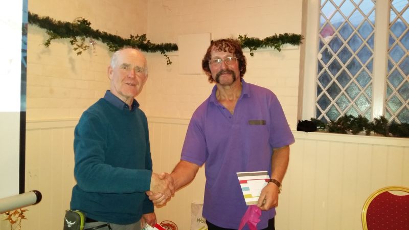
Over 30 members turned up for a very enjoyable but damp 14-mile walk led by Dawn Devine from Hambleden Village. At the end of the walk, the walkers were joined by a further 10 members for a festive party and hospitality laid on by Jan Sambrook and her trusty Elves, Trish, Bridget, Susan and Maureen at the village hall. Homemade soups, a hearty Ploughman’s and numerous puddings went down a treat with one and all.Our guest speaker Paul Lawrence, seen here in the picture receiving some festive cheer from Martin, gave an overview of some of his worldly travels with supporting photos; the scenery was indeed stunning and would inspire many a walker to greater challenges.
Maureen Downes.
Other Files
GPX
A GPX file of the above route may be downloaded by clicking the link below.
Note: GPX files of Group Walks are created by LDWA Group members, and may be downloaded only by other LDWA members. They should not be made available outside the LDWA, and are used at members' own risk.
Login to Download (Members Only)You can use the interactive controls to zoom in and out and to move around the map, or click on a path or a marker for more info. (interactive map help)
You can use the interactive controls to zoom in and out and to move around the map, or click on a path or a marker for more info. (interactive map help)
Contains Ordnance Survey data © Crown copyright and database right 2016.
© OpenStreetMap contributors under Open Database Licence
Rights of way data from selected Local Authorities
Large scale digital mapping is provided by John Thorn
At high zoom levels the route is indicative only.
© OpenStreetMap contributors under Open Database Licence
Rights of way data from selected Local Authorities
Large scale digital mapping is provided by John Thorn
At high zoom levels the route is indicative only.
Gallery
Maps:
You can use the interactive controls to zoom in and out and to move around the map, or click on a marker for more info. (interactive map help)
Contains Ordnance Survey data © Crown copyright and database right 2016.
© OpenStreetMap contributors under Open Database Licence.
Rights of way data from selected Local Authorities.
Large scale digital mapping is provided by John Thorn.
© OpenStreetMap contributors under Open Database Licence.
Rights of way data from selected Local Authorities.
Large scale digital mapping is provided by John Thorn.


