


Stour Valley (Joint w. Kent) - more walk details added 12/10
Sat 17th Oct 2015
Walk Details:
Event Details Updated
Note additional info compared to Strider (though outbound train times unchanged). and lunch arrangements.
Event Type
Group Walk
Region
Southern England
Local Group
London
Distance
18ml.
Start Time
09.50
Route
Start Canterbury West Stn main entrance (take 08.10 from Charing Cross or 08.37 from St Pancras change at Ashford). Ends at Sandwich Station for either 1806 via Ramsgate (change) or 1825 via Dover and Ashford to return to London
* Route is linear, mainly by Stour Valley path. Route is mainly flat and, apart from a heavy dew, was mainly dry on Saturday 10 Octobers recce. Walk through pretty Kent villages of Fordwich and Stodmarsh
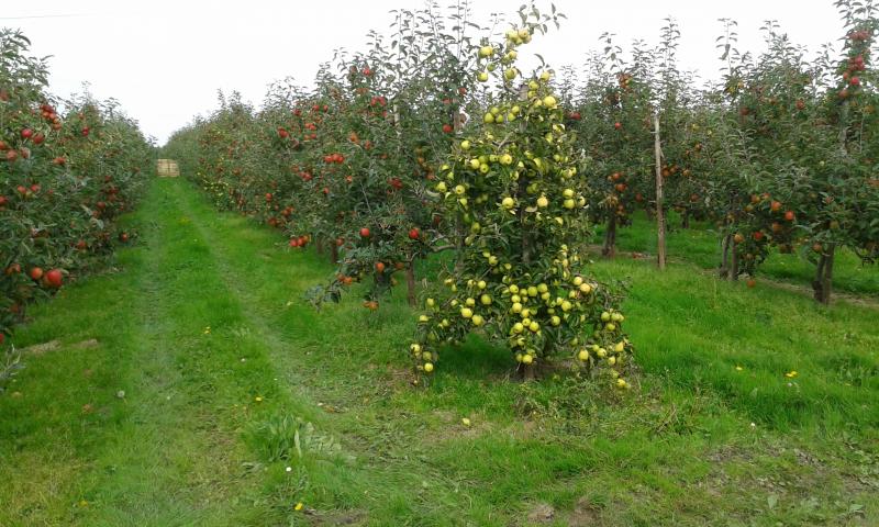
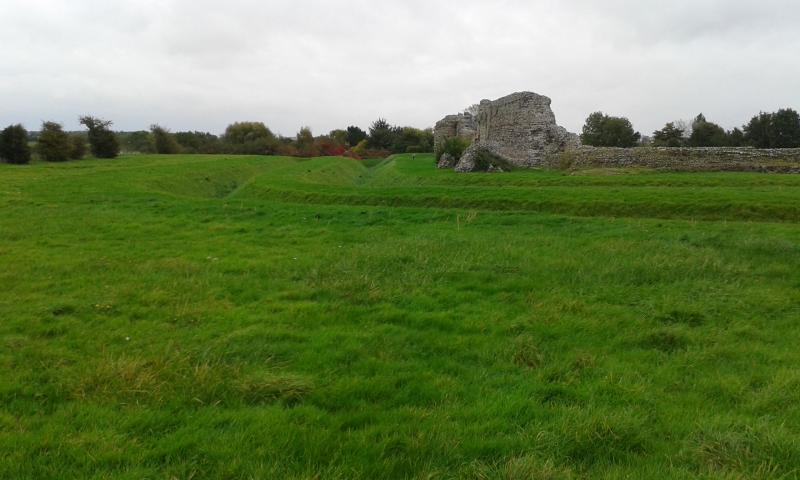
After 45 minutes for lunch, walk via West and East Stourmouth, and Westmarsh through many apple orchards, with a possible diversion to see the impressive Roman walls of Richborough Castle
General Notes
* Lunch at The Grove Ferry Inn near Upstreet or bring sandwiches
* Ticket inspector, Tomasz (apparently), advises buy a day return ticket to Ramsgate as South Eastern trains to East Kent go via that station; and check in advance for any offers available only on-line.
* Torches advised in case of dark finish
* No dogs
Web Site
Start
Finish
Entry Details:
Cost
Walk Report
Stour Valley, Saturday 17th October 20159 walkers, 18 miles - leader Roderick Smith
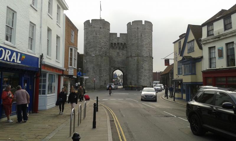
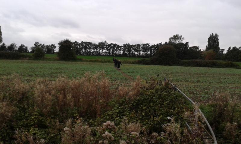
A group of nine Kent and London Group members, four ladies and five men, met at Canterbury West station and set off at 1000 to walk to Sandwich. We walked past Canterbury's West Gate and east along the High Street before turning towards the Cathedral and thence along Burgate to St Augustine's Abbey. Continuing east we soon left the main road and joined the Stour Valley Path.
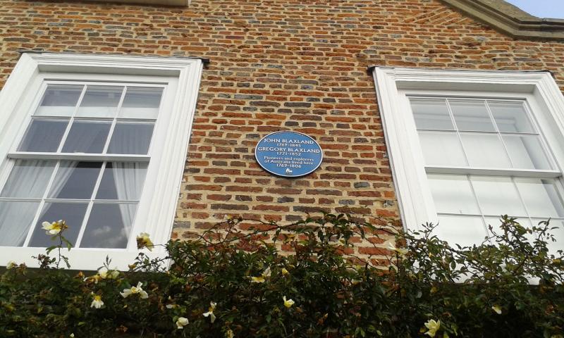
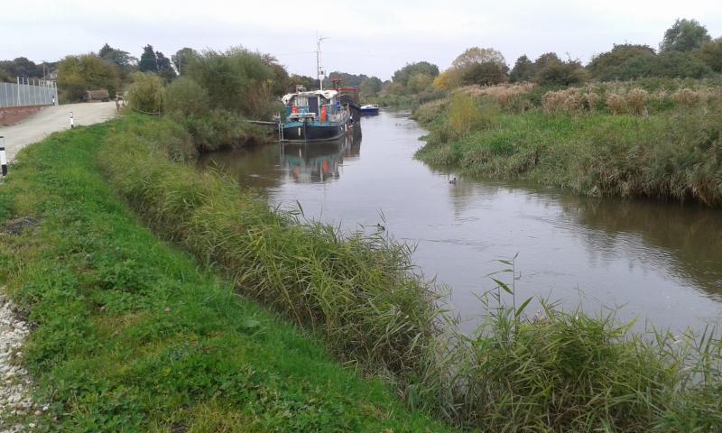
We passed a blue plaque in Fordwich commemorating John and Gregory Blaxland, early settlers in Australia, and reached our mid-morning tea and coffee stop at The Fordwich Arms by 1115 - beside the smallest and oldest Town Hall in England still in use. On to Stodmarsh and through a National Nature Reserve, walking beside the River Stour to lunch at The Grove Ferry Inn.
Lunch took a quick 45 minutes and we were on our way again by 1345. Crossing flat empty fields we reached West Stourmouth and went into its Churches Conservation Trust church. Passing through East Stourmouth, we reached the Rose Garden Tearoom at Westmarsh by 1515, where David generously treated us to an excellent slice of cake each to accompany tea and coffee.
Walking through several miles of apple orchards full of heavy fruit, we turned up to the impressive 25-feet high walls of the Roman fort at Richborough (RVTVPIAE) by 1640. After crossing the railway line, we continued by the River Stour into Sandwich reaching its station by 1715 in good time for the 1725 train to London via Dover having walked about 18.5 miles in 7.25 hours. A fine day out despite the grey overcast and cool north-east wind.
Photographs by Roderick Smith
Other Files
Download Walk ReportGallery


Maps:
You can use the interactive controls to zoom in and out and to move around the map, or click on a marker for more info. (interactive map help)
Contains Ordnance Survey data © Crown copyright and database right 2016.
© OpenStreetMap contributors under Open Database Licence.
Rights of way data from selected Local Authorities.
Large scale digital mapping is provided by John Thorn.
© OpenStreetMap contributors under Open Database Licence.
Rights of way data from selected Local Authorities.
Large scale digital mapping is provided by John Thorn.


